Will it snow this weekend? Latest Met Office UK weather forecast
The weather appears to have stabilised following a week-long cold snap
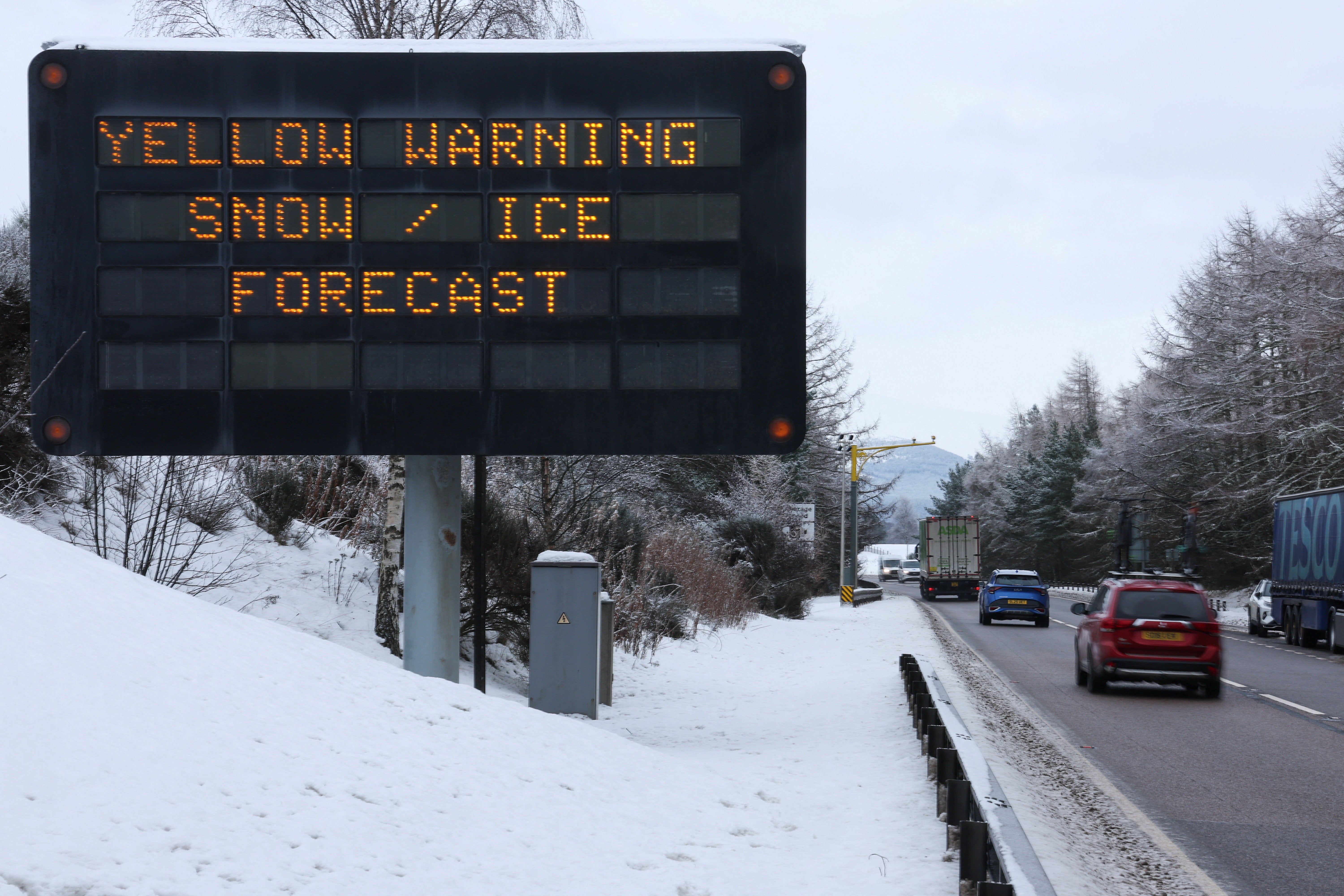
So far, 2026 has got off to a cold start after an Arctic blast brought heavy snow to Scotland and Storm Goretti left parts of the country without power.
Thousands of children in northern Scotland missed several days of school last week when wintry showers caused disruption across vast stretches of the country. The Met Office issued yellow snow and ice warnings as freezing temperatures impacted Scotland.
Other parts of the United Kingdom saw wind, ice, snow and rain after Storm Goretti was named a “multi-hazard event”. Officials in the West Midlands warned of the “worst snowfall in a decade” as parts of England and Wales saw 15 to 25cm.
Temperatures have since stabilised, although this week there have been yellow rain and fog warnings across parts of England and Wales. But is it possible we’ll see more snow this weekend?
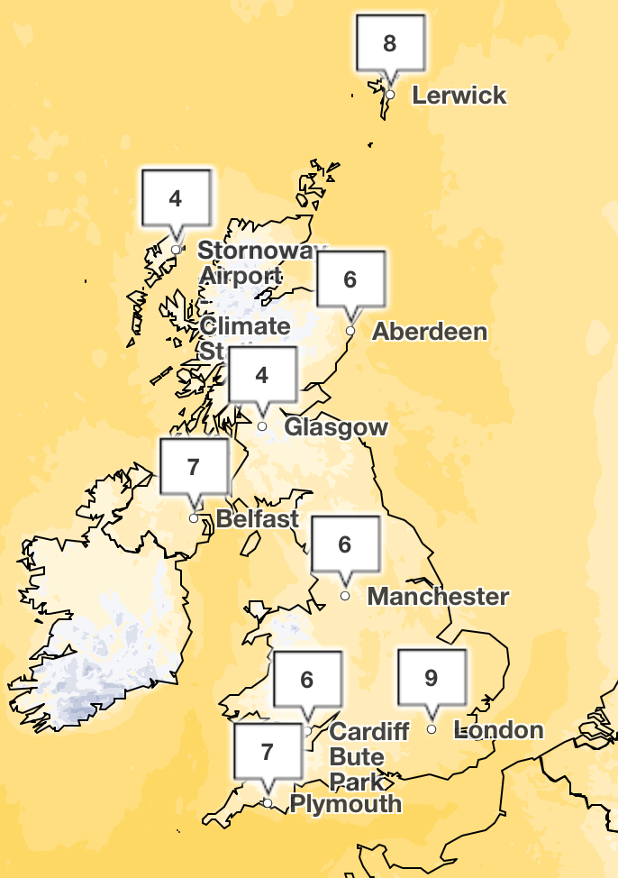
Snow looks unlikely across the UK, with temperatures remaining near average for this time of the year and lows of 4C this weekend in the north of England and Scotland, while London and the South East will see highs of 9C. The weather is set to remain showery, with a mix of fog patches and some frost in the North.
Liam Eslick, the Met Office’s senior operational meteorologist, told The Independent: “In the immediate future colder weather isn’t expected to return for the UK. Temperatures for most of next week should remain near average.
“While there’s still a slight possibility that winds from the East could bring a chill during the final week of January, that is still a long time away, giving time for the forecast to change. For now, it’s just as probable that milder southern air will persist, keeping the cold at bay.
“Any snow this weekend will be confined to the higher hills of Scotland, which isn’t unusual for mid-winter.”
Meteorologist Alex Deakin added that in the short term, the cold weather would not return, although temperatures next week could be a “touch below average”.
While the jet stream in the Atlantic appears active, it is weakening as it reaches the UK, which means weather patterns are slow-moving.
While low pressure is coming in from the Atlantic, northern Europe is experiencing a block of high pressure. This means less cold air or wind is coming towards the UK.

Met Office five-day weather forecast
Friday evening and overnight
Often cloudy, with some showers, these are most frequent in the West. Mixture of low cloud and fog patches across central and eastern areas, perhaps becoming quite extensive across eastern England. Risk of a frost in the North.
Saturday
Early fog patches slowly lifting, otherwise a day of sunny spells and showers, these heaviest and most frequent in the West but fading during the afternoon. Near normal temperatures.
Outlook for Sunday to Tuesday
A changeable few days. Often cloudy with some brighter spells and showery outbreaks of rain. Some overnight frost and fog patches, the fog locally freezing and slow to clear.
Join our commenting forum
Join thought-provoking conversations, follow other Independent readers and see their replies
Comments
Bookmark popover
Removed from bookmarks