Met Office issues fresh rain warnings in parts of UK hit by Storm Chandra flooding
A yellow weather warning is now in place across Devon and Cornwall on Monday and Tuesday morning
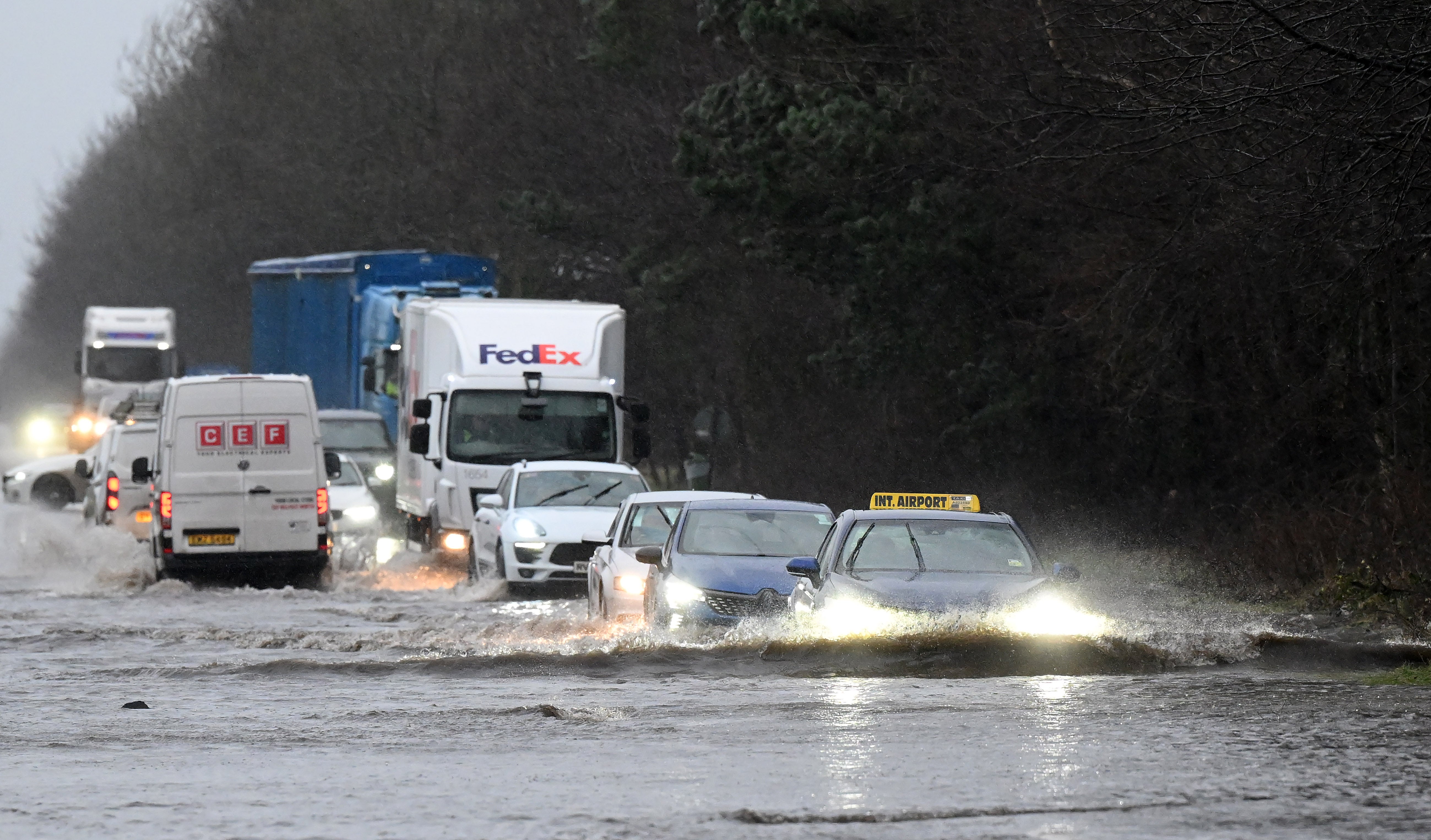
The Met Office has issued fresh weather warnings for rain in southwest England after the region was hit by flooding during Storm Chandra earlier this week.
Further rainfall is expected on Monday and Tuesday across Cornwall and Devon, less than a week after schools were forced to close and transport was disrupted due to the adverse weather.
A yellow weather warning is in place from midday on 2 February until 9am the following day, with the forecaster warning that there is a small chance homes and businesses could be flooded, while deep floodwater could cause danger to life.
A yellow rain alert is currently in place for Devon and Cornwall on Friday, lasting to 6am on Saturday for an area stretching from Land’s End to Exeter.
Met Office chief forecaster Rebekah Hicks said: “Over the next few days we’ll see more rain into areas of the country which have already been hit by flooding, and the saturated ground contributes to the ongoing likelihood of some disruption caused by the coming rain.
“The totals we’re expecting aren’t comparable to Storm Chandra, but with around 25mm possible each day in parts of the yellow warning areas, it could be sufficient to lead to difficult travel conditions and further flooding in places.”
Meanwhile, the RNLI is warning people to be vigilant near the coast in Devon and Cornwall due to the potential of 15ft waves surging up exposed beaches and topping over sea fronts and harbour walls.
Steve Instance, from the charity, said: “Current forecasts for Friday are predicting wave heights between 10ft and 15ft, which isn’t unusual for this time of year, however, what makes this particularly worrying is the long lull, or swell period between the waves.
“Surf forecasts are predicting a 17-second swell period. What this looks like is a gap between sets of very large, very powerful waves of up to 15 minutes.
“This could mean, particularly close to high tide in the middle of the day, people walking on beaches or along sea fronts will be faced with a sudden surging set of waves racing 200 metres to 300 metres up the beach, or topping over sea or harbour walls.
“There is a risk this could catch walkers out and in the worst case sweep them off their feet into the sea.”
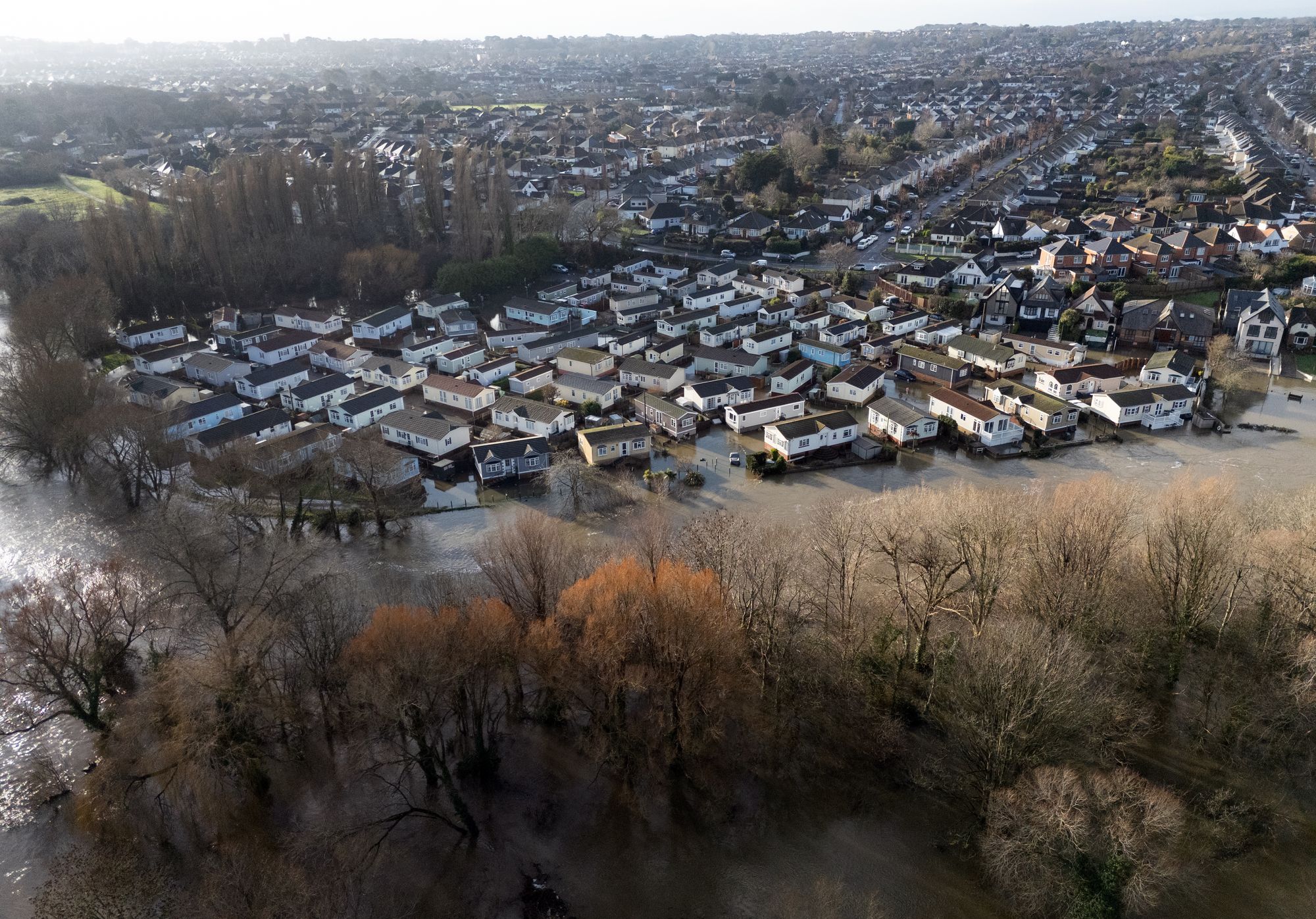
On Wednesday, Somerset Council said an estimated 50 properties had been affected by flooding across Ilminster, West Coker, Taunton, Mudford and West Camel.
The Flooding on the Levels Action Group (Flag), which has long campaigned for improvements to drainage and flood alleviation on the Somerset Levels, is calling for the pumping station at Northmoor to be upgraded.
Meanwhile, status yellow rainfall warnings are in place for seven counties in the Republic and for all counties in Northern Ireland.
Met Eireann extended the rainfall warning as it will come into effect from noon for counties Dublin, Carlow, Kilkenny, Louth, Waterford, Wexford, and Wicklow until midnight.
In Northern Ireland, there is a yellow-level warning for rain in place until 6pm on Friday, bringing a risk of further flooding and travel disruption.
The five-day weather forecast:
Today:
Rather cloudy and breezy with rain moving northwards, giving snow over some northern hills. Briefly brighter in the south, though heavier rain and strong winds developing from the south and west during the afternoon. Feeling rather cold in the north.
Tonight:
Bands of rain or showers affecting many areas of the country, some heavy bursts across the southwest. Some drier spells, especially towards the northwest where a local frost is possible.
Saturday:
Often cloudy, perhaps with a few brighter spells in the east. Outbreaks of light rain and drizzle possible almost anywhere. Heavier rain and showers in the southwest edging slowly northwards.
Outlook for Sunday to Tuesday:
Remaining unsettled on Sunday and to start next week. Showers or longer spells of heavy rain affecting most areas, coupled with brisk winds at times. Further snow on northern hills.
More follows...
Join our commenting forum
Join thought-provoking conversations, follow other Independent readers and see their replies
Comments
Bookmark popover
Removed from bookmarks