Storm Ingrid map: Where snow and heavy rain are set to hit this weekend as 60mph winds forecast
Storm Ingrid brings more weather warnings to the UK as downpours continue
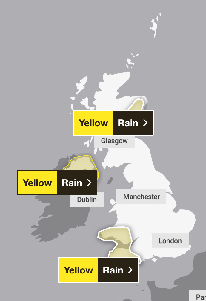
The Met Office has issued multiple weather warnings over the weekend as Storm Ingrid descends upon the UK with heavy rain, lashing winds, and snow.
Three separate yellow weather warnings for rain are in place over the weekend for the south west of England, Wales, parts of eastern Scotland, and Northern Ireland.
The south west of England and Wales has been under a heavy rain warning since 2am on Friday, set to last until 10pm Saturday, as the Met Office warns Storm Ingrid (named by IPMA, the Portuguese Met Service), will slowly drift northwards over the Celtic Sea during Saturday.
Bands of frequent heavy showers revolving around its centre, merging into longer spells of rain at times. An additional 20-40 mm, and in a few exposed locations, 50 mm of rainfall is expected to fall.
Meanwhile, eastern parts of Scotland will see a further 20-30 mm of rain, and a few spots could see 50 mm, after three days of wet weather across the region, set to last until 9am on Sunday. Some places have already seen in excess of 100mm of rain. Above 400-500 metres, however, a lot of this will fall as snow, with rain confined to areas of ground below this level.
Northern Ireland will see heavy rain overnight from 8pm Saturday into Sunday at 9am. As part of the slow-moving low-pressure system, 10-20 mm is expected widely and in a few spots as much as 25 mm could fall in a 12 hour period, leading to localised flooding and difficult driving conditions.
It will also become windy with easterly winds gusting 30 to 35 mph inland and to 45 to 55 mph on some coasts and over high ground. Winds will ease after midnight.
Perth and Kinross Council said many roads in the region were closed due to flooding as of 6am on Friday, including the A94 between A93 Meikleour crossroads and A923 Bendochy crossroads, and the Queen’s Bridge in Perth.
Two people were rescued from a minibus on the B977 near Kintore at around 8.30am on Thursday, while another person was brought to safety from a car in a separate incident at around the same time near Banchory.
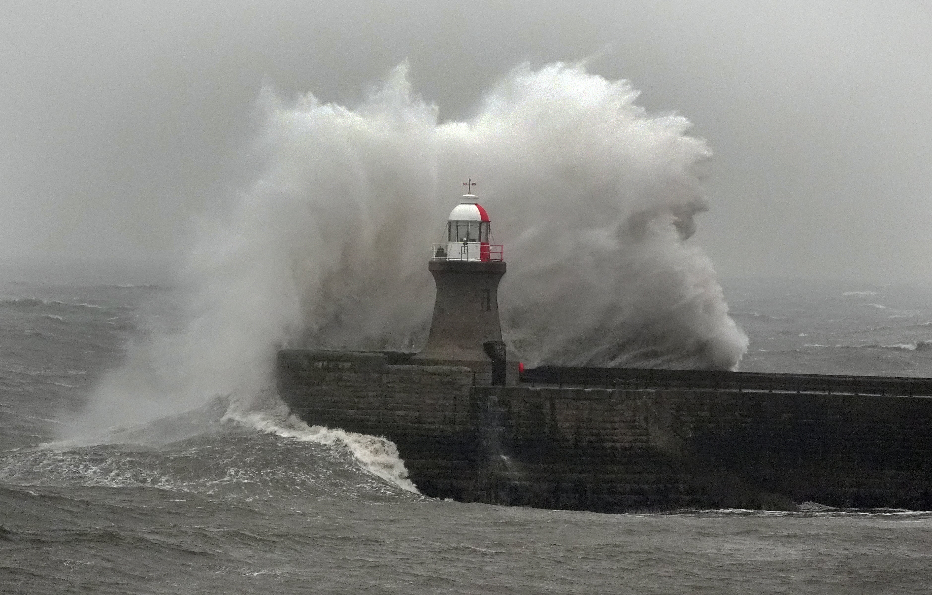
Across the south west of England and Wales, gusts of 45 to 50mph battered the inland, with winds peaking during Friday evening before gradually easing overnight into Saturday morning.
The Environment Agency has issued 30 flood warnings, where flooding is expected, and 152 flood alerts, where flooding is possible. The Scottish Environment Protection Agency issued 11 flood warnings and four flood alerts. Three alerts are in place across Wales, according to Natural Resources Wales.
Met Office Chief Forecaster, Andy Page, said: “Unsettled weather continues for many across the UK with persistent and heavy rain in parts of Scotland with snow over higher ground, and strong winds and heavy rain in southwestern England and southern Wales. Elsewhere, while it’ll be a breezy weekend, there will be brighter and drier spells with occasional showers passing through fairly quickly.”
The areas affected are:
- Cornwall
- Devon
- Dorset
- Plymouth
- Somerset
- Torbay
- Blaenau Gwent
- County Antrim
- County Armagh
- County Down
- County Fermanagh
- County Londonderry
- County Tyrone
- Bridgend
- Caerphilly
- Cardiff
- Carmarthenshire
- Ceredigion
- Merthyr Tydfil
- Monmouthshire
- Neath Port Talbot
- Newport
- Pembrokeshire
- Powys
- Rhondda Cynon Taf
- Swansea
- Torfaen
- Vale of Glamorgan
- Angus
- Perth and Kinross
- Aberdeen
- Aberdeenshire
Join our commenting forum
Join thought-provoking conversations, follow other Independent readers and see their replies
Comments
Bookmark popover
Removed from bookmarks