Snow and ice warnings issued as flooding expected in more than 70 areas
The Environment Agency has urged the public to remain vigilant amid the ongoing flood risk.
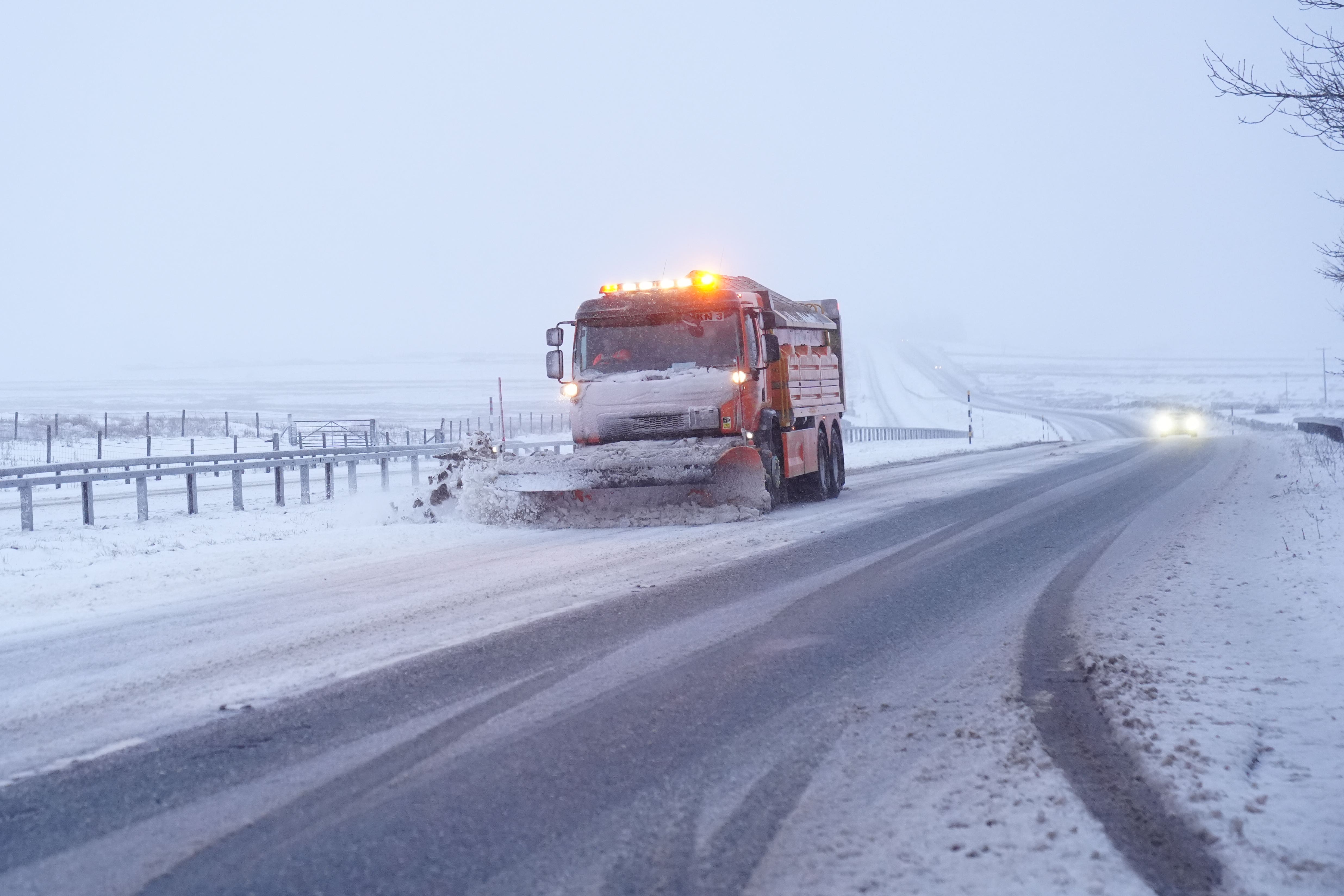
Yellow snow and ice warnings have been issued for large parts of the UK as flooding is expected in more than 70 areas.
A series of warnings expired throughout Saturday, but a snow and ice warning covers most of Scotland and large parts of England until 10am on Sunday, and a new snow warning has been issued covering parts of eastern England from 10am until 4pm.
Meanwhile, the Environment Agency has urged the public to remain vigilant amid the ongoing flood risk.
There were 74 flood warnings and 162 flood alerts in place across England on Sunday morning.
Jonathan Day, flood duty manager at the Environment Agency, said more than 24,000 homes and business have been protected but about 330 have been flooded.
The yellow warning for snow and ice stretches from Derby across the majority of Scotland and the Met Office said snow in these areas might be “heavy at times”, adding this could cause “some disruption to travel”.
It said “accumulations of 1-3cm (of snow) will be possible at low levels, with 3-7cm possible above about 150m elevation, and perhaps 10-15cm above 400m”.
The warning on the Met Office’s website says: “Areas sheltered to the north of high ground may see very little snow.
“Ice will be an additional hazard, particularly across north-east England and parts of Scotland where precipitation has the potential to fall on frozen ground, leading to very slippery conditions.
“Snow will turn increasingly to rain into Sunday morning, perhaps as a short spell of freezing rain in places, before eventually clearing to the east with a steady thaw of lying snow then setting in.”
The snow warning for eastern England says “a spell of snow may lead to some disruption to travel”.
It adds: “Rain moving eastwards through Sunday morning is likely to turn increasingly to sleet and snow.
“Slushy accumulations of 1cm or so are likely, with a chance of 2-4cm should snow turn briefly heavier, this more likely for the Lincolnshire Wolds and parts of Norfolk and Suffolk.”
Met Office meteorologist Greg Dewhurst said Sunday will have a blustery start for many and outbreaks of showery rain, with some hill snow.
Milder air will move into the South West and parts of Cornwall and Devon could reach 12C, while it will be about 4C or 5C in the east, he said.
Next week will bring unsettled and blustery conditions with showers across the whole of the country, which will ease into Tuesday, then another weather system will arrive on Wednesday bringing more unsettled weather. Thursday is expected to be drier.
Bookmark popover
Removed from bookmarks