Los Angeles gets rare blizzard warning as historic winter storm shuts down parts of Midwest
Public officials warned people to keep off the roads due to extremely dangerous whiteout conditions in parts of the Midwest and northern plains
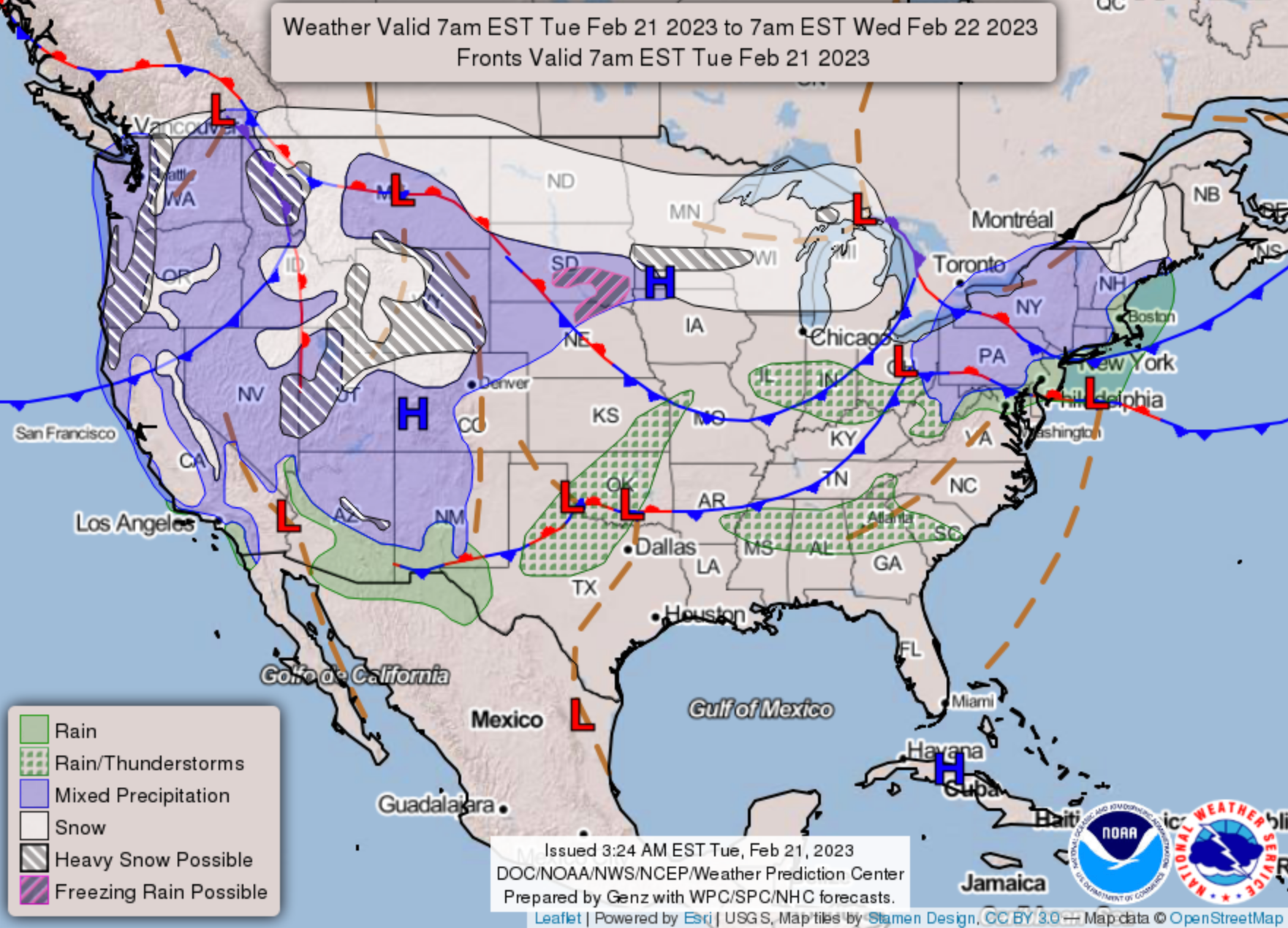
Half a dozen states were largely shut down on Wednesday as a historic winter storm bearing heavy snowfall and bitterly cold temperatures descended on the northern plains and Midwest.
Schools were closed in North Dakota, South Dakota, Minnesota and Wisconsin while public officials warned people to keep off the roads due to dangerous whiteout conditions.
A slew of weather warnings, watches and advisories were issued in nearly two dozen states by the National Weather Service (NWS) with forecasts revealing severe impacts from coast to coast.


In California, a rare blizzard warning was issued for mountains in Los Angeles County and Ventura County from early on Friday morning until Saturday afternoon.
In the meantime, California can expect yet more rainfall after being deluged by a wave of atmospheric rivers at the beginning of the year.
Moderate rainfall, but heavy in some spots, and thunderstorms are forecast in the Pacific Northwest on Wednesday before moving south and settling over California on Thursday.
In the Twin Cities of Minneapolis and St Paul, the first round of wintry conditions dropped three to five inches of snow across the area. The flurries will pick up in intensity by Wednesday afternoon, NWS reported.
The February record of 13.8 inches of snow from a single storm in Minneapolis “is likely to be smashed,” reported AccuWeather meteorologist Matt Benz.
The late winter storm will shift east as the week goes on. More than 12 inches of snow is likely for high elevations in the Adirondacks and the Green and White Mountains, with lighter accumulations of up to four inches across upstate New York and central New England.
Freezing rain or sleety conditions will drive across southern New England before easing off by Friday.
Travel woes were already beginning to mount up at US airports. More than 1,000 flights had been cancelled in the US and another 1,000 or so delayed, according to FlightAware on Wednesday morning. The worst affected airports were in Minneapolis-St Paul, Denver and Detroit.
Aside from the snowfall, there is a slight risk of excessive rainfall from northeast Missouri into northern Illinois, northern Indiana, and southern Michigan and some spots of flash flooding.
Parts of the west and High Plains will experience very strong winds of 50-60 mph, and as high as 80 mph in some locations. The risk of weather that can spark fires will be elevated across the southern High Plains through Wednesday.
Beside the glut of precarious weather conditions, there will be wide variations in February temperatures.
Many record-tying or record-breaking highs can be expected particularly for the Ohio and Tennessee valleys, where temperatures will climb above 70 degrees Fahrenheit.
Closer to the Gulf Coast and Florida, highs will soar into the 80s. In Marathon, Florida, the daily high temperature record was tied for the second day in a row as it hit 86F.
On the flipside, record lows will be possible in the west, with temperatures in the 30s and 40s for the Pacific Northwest and 50s in California. Bitterly cold wind chills, some 20-30 degrees below zero, are expected for the Northern Plains.
Join our commenting forum
Join thought-provoking conversations, follow other Independent readers and see their replies
Comments
Bookmark popover
Removed from bookmarks